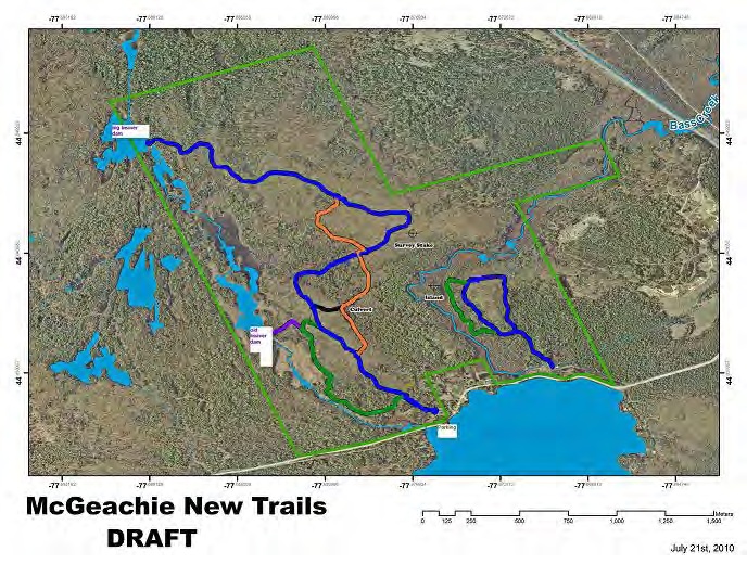
Visit the McGeachie Trails
The McGeachie Trails are located on Steenburg Lake North Road, off of Hwy #62 just past the beach area.
Look for the sign which leads to the parking area.
The trails are open for Walking, Hiking, Cross-Country Skiing, and Snowshoeing.
If you bring your pet with you, then please clean up after him. Please keep these trails clean and enjoy them at your own risk.
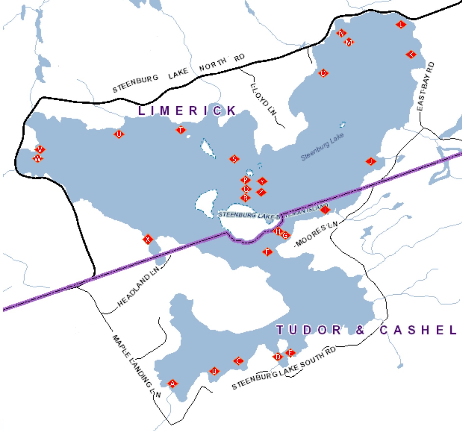
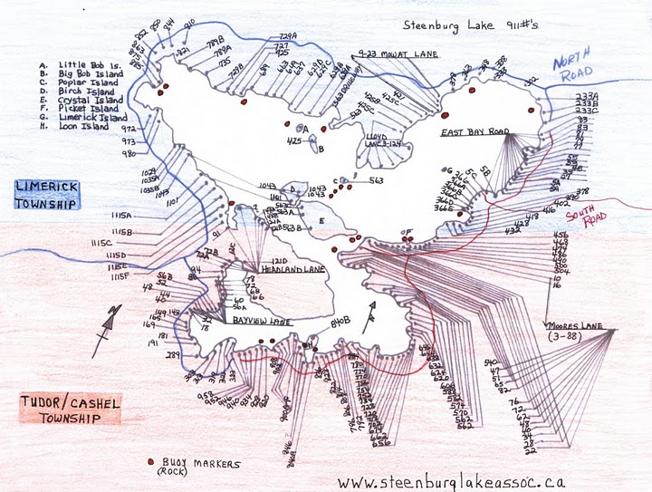
Rock Markers on Steenburg Lake
The SLCA places Rock Markers around Steenburg Lake as seen on this map as a courtesy to the those who enjoy the lake.
Locations are approximate, and this service is provided on a ‘best effort’ basis only. Registered members can report observations here.
The SLCA cannot be held responsible for any damage that may be caused by these rocks. We didn’t put them there, but we would like to help you avoid them.
Please enjoy the lake at your own risk.
Steenburg Lake Fishing Zone 15
Largemouth and Smallmouth Bass
Season: fourth Saturday in June to November 30
Limits: S-6 and C-2
https://www.ontario.ca/document/ontario-fishing-regulations-summary/fisheries-management-zone-15
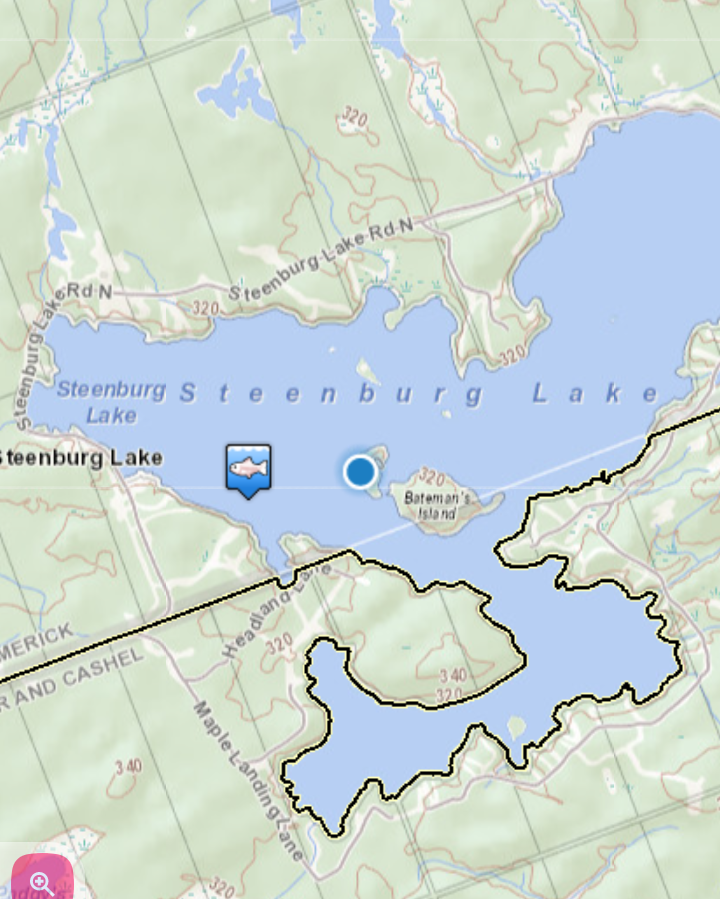
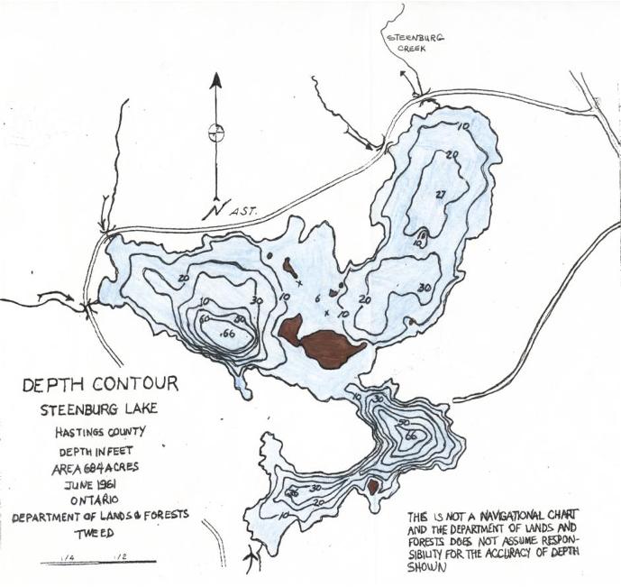
Steenburg Lake Depth Map
At its deepest points, Steenburg Lake is approximately 66 feet, however, the water depth varies across the lake.
This map provides a guideline of the water depth around the lake.
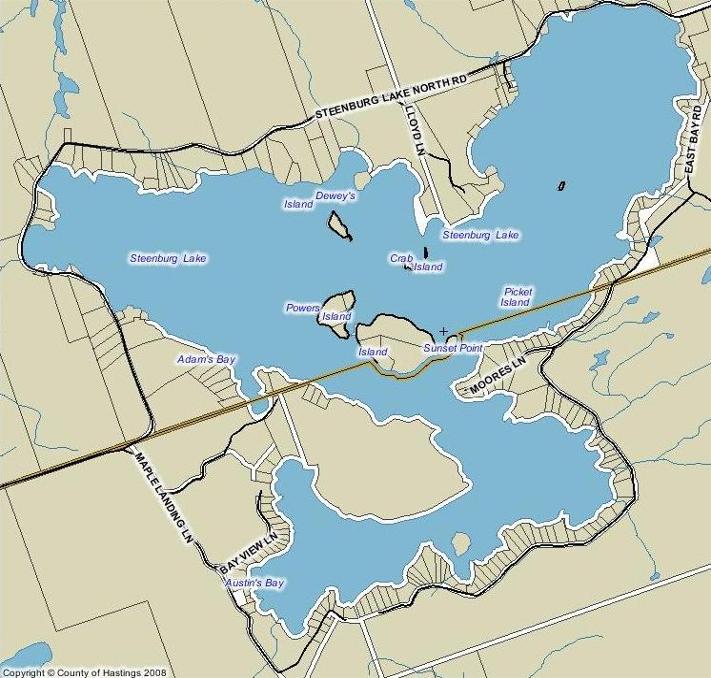
Property locations with 911 Emergency identifiers
Properties developed on Steenburg Lake (originally Bass Lake) were assigned a numerical identifier that was eventually replaced with 911 markers.
The 911 markers make it easier to identify the location of a property on Steenburg Lake for guest, and emergency services.
County of Hastings GIS Maps
Additional maps of the area are available from the Hastings County Geographic Information System (GIS) at https://hastingscounty.com/services/gis-mapping/